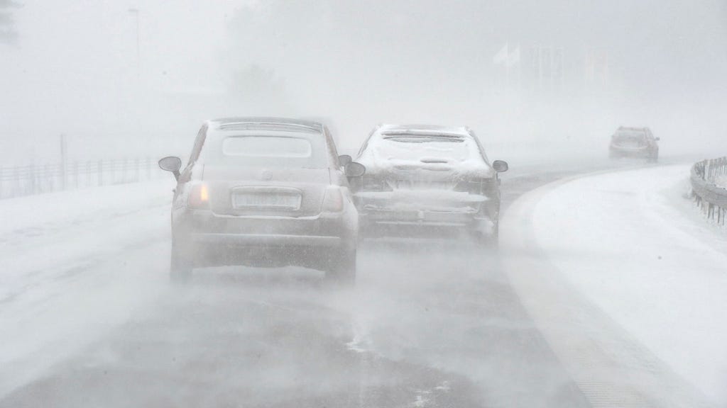
A yellow weather warning for snowfall has been issued by the Swedish Meteorological and Hydrological Institute (SMHI) for western parts of Götaland and Svealand, impacting regions such as Västra Götalands län, Skaraborg, Dalsland, and Jönköpings län. The warning, in effect from 8:00 AM Thursday until evening, anticipates up to a decimeter of snow accumulation accompanied by northeasterly winds. The combination of snowfall, slush, and temperatures hovering around zero degrees Celsius will create muddy and slippery road conditions, necessitating cautious driving. As the day progresses, the snowfall is expected to spread eastward, reaching Värmland, Dalarna, and Gävleborgs län by evening. While the system will continue to move northwards, reaching Norrbotten by Friday morning, it is expected to weaken significantly, posing less of a threat.
The anticipated snowfall event is not indicative of a sustained shift to winter weather. Mild conditions are forecast to persist for several days following the snow, extending throughout the weekend and into the early part of the following week. This suggests that any accumulated snow in the southern regions will likely melt relatively quickly. The temporary nature of this snowfall event underscores the ongoing variability of weather patterns in the transition period between autumn and winter.
This specific weather warning focuses on the immediate impacts of the snowfall, primarily highlighting the potential for hazardous travel conditions. The accumulation of up to 10 centimeters of snow coupled with near-freezing temperatures creates a risk of slush and ice formation on roads, increasing the likelihood of accidents. Drivers are advised to exercise caution, reduce speed, and maintain a safe following distance. The warning also indirectly addresses potential disruptions to daily routines, particularly for commuters and those engaging in outdoor activities.
Understanding the implications of a yellow weather warning is crucial for preparedness. In this case, it signifies potential disruptions but not widespread or severe damage. It serves as a notice to be aware of changing weather conditions and to take necessary precautions. While not as serious as an orange or red warning, which signify more significant and widespread impacts, a yellow warning necessitates a level of awareness and preparation to mitigate potential risks.
The evolution of the weather system, moving northwards and weakening over time, suggests a gradient of impact. The southern regions, experiencing the initial and most intense snowfall, will bear the brunt of the hazardous conditions. As the system progresses north, its impact diminishes, transitioning to lighter snowfall with less potential for disruption. This highlights the importance of localized weather information, as the severity of the event will vary significantly across the affected regions.
The overall message from SMHI emphasizes preparedness and caution in the face of changing weather conditions. While the snowfall is not predicted to be a prolonged or severe event, the combination of snow, wind, and near-freezing temperatures creates a temporary risk of hazardous travel conditions. Heeding the warning, adjusting travel plans if necessary, and exercising caution on the roads are crucial steps in mitigating potential risks associated with this weather event. The forecast for continued mild weather following the snowfall further contextualizes the event as a transient weather fluctuation rather than a permanent shift into winter conditions.


