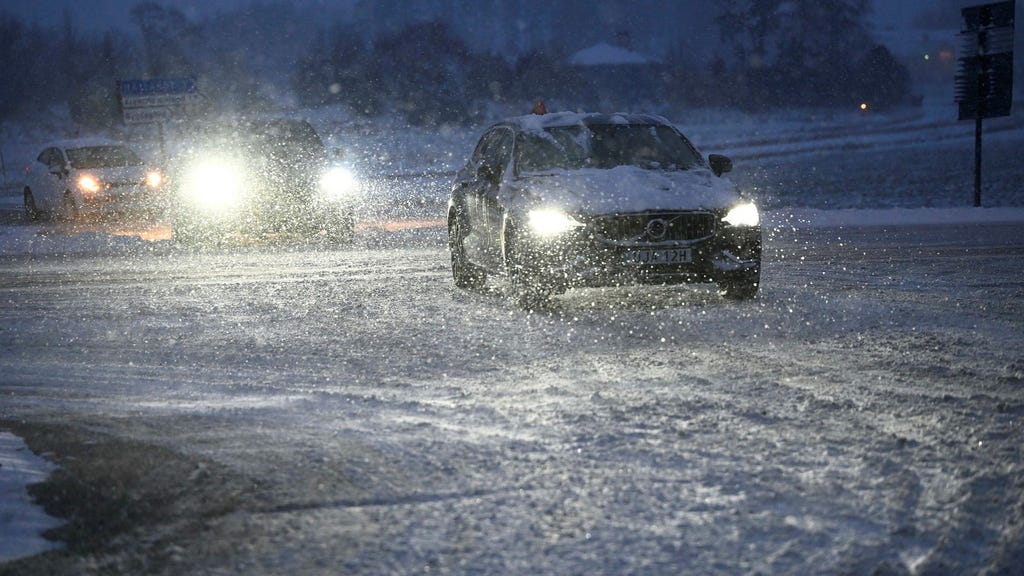
The onset of winter has arrived early in parts of Sweden, with snowfall already gracing Dalarna on Monday evening. This wintry precipitation, accompanied by a drop in temperatures, is forecast to progress southward during the night, blanketing regions with a layer of snow and ushering in a period of colder weather. The Swedish Meteorological and Hydrological Institute (SMHI) has issued yellow warnings for snowfall across Svealand and western Götaland, indicating the potential for significant accumulations and potential disruptions. This shift towards colder conditions marks a departure from the unseasonably mild weather experienced in recent weeks, signaling a return to more typical temperatures for this time of year.
The incoming cold air mass interacting with existing moisture is the driving force behind this weather event. Meteorologist Mattias Lind from SMHI explains that this interaction will result in a widespread area of rain and snowfall, with some locations potentially experiencing heavy snowfall. This precipitation, combined with the falling temperatures, creates a risk of hazardous road conditions. The primary concern is snow-induced slipperiness, but the potential for icy patches also exists, particularly as the weather clears and any remaining moisture on road surfaces freezes. This combination of snow and ice poses a significant threat to road safety, potentially leading to longer travel times and difficulties in commuting.
The anticipated impact on traffic is a key concern. SMHI predicts disruptions due to the challenging road conditions, advising motorists to anticipate delays and exercise caution. While the snowfall is expected to extend as far south as Småland and Östergötland, the predicted accumulations in these regions are not significant enough to warrant official warnings. However, even lighter snowfall can contribute to slippery conditions, and drivers in these areas should remain vigilant. The cold weather is expected to persist through Wednesday and Thursday, with nighttime temperatures potentially dropping below -10°C across large swathes of the country.
Following this cold snap, a significant shift in the weather pattern is anticipated, bringing milder temperatures across the entire nation. This temperature rebound will be particularly pronounced in northern Sweden, where a dramatic swing from double-digit sub-zero temperatures to above-freezing conditions is forecast. This rapid warming trend will extend as far north as Västerbotten by the weekend, highlighting the dynamic nature of the weather system. This shift marks a return to more seasonal norms after a period of unusually mild weather.
The southern regions of Sweden, which have enjoyed significantly higher-than-average temperatures in recent weeks, will also experience this transition to more typical winter conditions. Although the immediate forecast calls for a period of colder weather, the subsequent warming trend will not bring temperatures significantly above freezing. Instead, the expected maximum temperatures will hover around a few degrees above zero, aligning more closely with the expected climate for this time of year. This return to more typical temperatures, while still relatively mild, represents a significant change from the recent unseasonably warm conditions.
In summary, Sweden is experiencing a transition from unusually mild autumn weather to more typical winter conditions. This transition is marked by the arrival of snowfall, particularly in central and northern regions, accompanied by a drop in temperatures. The SMHI has issued warnings for snowfall, and motorists are advised to exercise caution due to the potential for hazardous road conditions. Following this cold snap, a period of milder weather is expected across the country, although temperatures will remain closer to seasonal averages compared to the preceding weeks. This dynamic weather pattern highlights the variability of the Swedish climate and underscores the importance of preparedness for changing conditions.


